


Voting District 21080, Kern County, California
About
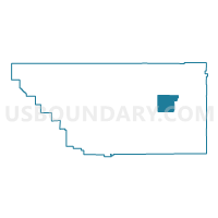
Outline

Summary
| Unique Area Identifier | 531736 |
| Name | Voting District 21080 |
| County | Kern County |
| State | California |
| Area (square miles) | 153.24 |
| Land Area (square miles) | 153.20 |
| Water Area (square miles) | 0.04 |
| % of Land Area | 99.97 |
| % of Water Area | 0.03 |
| Latitude of the Internal Point | 35.35031510 |
| Longtitude of the Internal Point | -118.14756650 |
Maps


Graphs
Select a template below for downloading or customizing gragh for Voting District 21080, Kern County, California


Neighbors
Neighoring Voting District (by Name) Neighboring Voting District on the Map
- Voting District 10010, Kern County, CA
- Voting District 10655, Kern County, CA
- Voting District 10660, Kern County, CA
- Voting District 10665, Kern County, CA
- Voting District 10670, Kern County, CA
- Voting District 20015, Kern County, CA
- Voting District 20600, Kern County, CA
- Voting District 21075, Kern County, CA
- Voting District 21085, Kern County, CA
- Voting District 21090, Kern County, CA
- Voting District 21095, Kern County, CA
- Voting District 21130, Kern County, CA
- Voting District 21135, Kern County, CA
- Voting District 21165, Kern County, CA
Top 10 Neighboring County Subdivision (by Population) Neighboring County Subdivision on the Map
- East Kern CCD, Kern County, CA (78,648)
- Tehachapi CCD, Kern County, CA (36,300)
- Lake Isabella CCD, Kern County, CA (16,234)
Top 10 Neighboring Elementary School District (by Population) Neighboring Elementary School District on the Map
- South Fork Union Elementary School District, CA (3,680)
- Caliente Union Elementary School District, CA (915)
Top 10 Neighboring Secondary School District (by Population) Neighboring Secondary School District on the Map
Top 10 Neighboring Unified School District (by Population) Neighboring Unified School District on the Map
- Sierra Sands Unified School District, CA (35,267)
- Tehachapi Unified School District, CA (35,209)
- Mojave Unified School District, CA (18,880)
Top 10 Neighboring State Legislative District Lower Chamber (by Population) Neighboring State Legislative District Lower Chamber on the Map
Top 10 Neighboring State Legislative District Upper Chamber (by Population) Neighboring State Legislative District Upper Chamber on the Map
Top 10 Neighboring 111th Congressional District (by Population) Neighboring 111th Congressional District on the Map
Top 10 Neighboring Census Tract (by Population) Neighboring Census Tract on the Map
- Census Tract 65, Kern County, CA (5,152)
- Census Tract 52.03, Kern County, CA (4,679)
- Census Tract 60.04, Kern County, CA (1,601)